
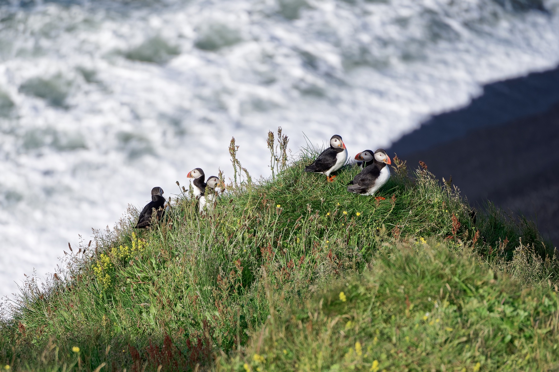
South Iceland's Puffin Coast
A road trip from Reykjavík to Vík, with the puffin cliffs at Dyrhólaey as the highlight and Heimaey as an optional add-on.
- Fly into
- Reykjavík · KEF
- Shortest trip
- 5 nights
- Ideal stay
- 7-9 nights
- Best time
- Every year, June 26–mid-August
Why go
Iceland's South Coast links waterfalls, black-sand beaches, glaciers and villages in one compact drive, with Vík as a good base. Dyrhólaey has a sea arch, nesting cliffs, marked paths and a lighthouse viewpoint. At Reynisfjara the basalt scenery is stunning, but follow the warning lights and stay well back from the surf.
- Where
- South Iceland
- Language
- Icelandic
- Currency
- ISK
- Time zone
- Greenwich Mean Time
- Best time
- Every year, June 26–mid-August
- Typical conditions
- July is cool on the South Coast. Wind can be extreme and beach conditions change fast, so check before you go.
Plan for 7-9 nights. That leaves time for Reykjavík and an unhurried south-coast drive, with spare days in case weather closes a road or headland.
 The place
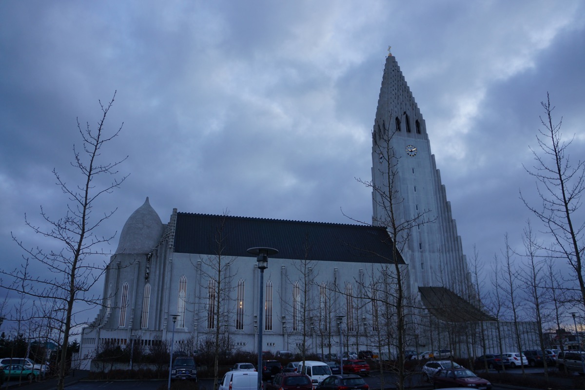
Hallgrímskirkja gives Reykjavík's opening chapter a distinct architectural landmark before the south-coast route.
The route
Follow the stops in order.
For orientation only. Use a map app for directions.
- 01Reykjavík
- 02South Coast
- 03Dyrhólaey
- 04Vík
Highlights
- 01
South Coast
South Coast · Full day · Road from Reykjavík · Selected stops · Check weather
- Why it fits
- The waterfall corridor introduces the glacier-fed rivers, volcanic cliffs and vast, weather-worn landscapes of South Iceland.
- Useful time
- Reserve a full road day for a small selection of waterfalls and coastal landscapes.
- From base
- Use the South Coast road linking waterfalls, black-sand beaches, glaciers and villages.
- Effort and access
- Choose a limited set of waterfalls and black-sand coast stops along the road route.
- Seasonal note
- The official South Coast route is presented as a year-round road journey.
- 02
Dyrhólaey
Dyrhólaey · 1.3 km one way · Near Vík · Moderate incline · Check weather
- Why it fits
- Dyrhólaey unites sea cliffs, a natural arch and protected nesting habitat in one defining coastal landscape.
- Useful time
- Allow two to three hours for Dyrhólaey’s upper and lower parking areas and the 1.3 km path between them.
- From base
- Drive from Vík on the open lawful approach and return without an unsourced shortcut.
- Effort and access
- Stay on marked paths and back from cliffs; wind and uneven ground constrain access.
- Seasonal note
- The selected window begins after the published May 1–June 25 discretionary bird-protection interval; current weather and access still govern the day.
- 03
Vík
Black-sand coast · Heed warnings · Near Vík · Stay back · Closures possible
- Why it fits
- Vík and Reynisfjara pair local coastal life with the basalt, black sand and powerful Atlantic surf that define the region.
- Useful time
- Place the black-sand coast within a full day on the South Coast route, centered on warning lights, closures and staying back from the water.
- From base
- Treat Vík and the black-sand coast as named stops on the South Coast route.
- Effort and access
- Never approach the water; obey the live warning system and required distance.
- Seasonal note
- At the black-sand beach, heed warning lights and closures because conditions can change quickly.
A closer look
 Along the way
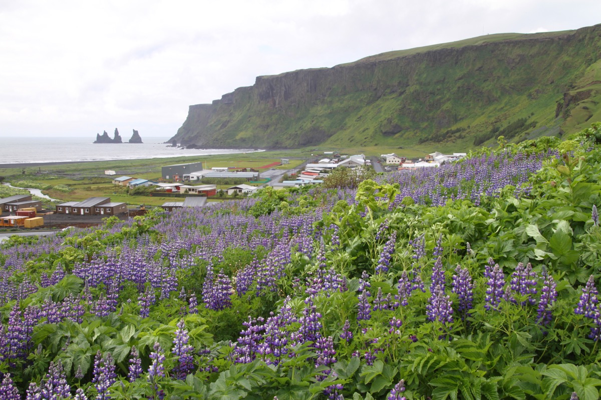
Reynisdrangar and Vík make the south-coast base legible as a permanent place beyond the Journey's wildlife anchor.
When to go
- Best time
- Every year, June 26–mid-August
- Why then
- Puffin season on the South Coast
See the moment - Time zone
- Greenwich Mean Time
Stop by stop
The stops in order. Set your own pace day to day.
- 01
Reykjavík
- 02
South Coast
- 03
Dyrhólaey
- 04
Vík
Before you book
Book first
- A car
- Check Dyrhólaey access
- Road status for Route 1 and Route 218
Know before you go
- Respect the hazard zones on black-sand beaches
- No drones without permission
- No off-road driving, and keep back from cliff edges
Keep in mind
- Puffins are seasonal and never guaranteed.