Historical monthly weather
Sweet spotPeak May, Jun, Aug. Go in Apr, Jul, Nov for similar weather.
Sunny share of daylightOct · 72%
WarmestJul · 88°F
WettestMar
Best windowJun–Sep
Bar height is the typical daytime high; color shows sunny share of daylight. The shaded months are the ideal window to go.
Weather data & source
2018–2023 averages, not a forecast. Wet days estimate days with at least 1 mm of rain or snow using a calibrated ERA5 threshold. Contains modified Copernicus Climate Change Service information. Weather data by Open-Meteo.com (AWS Open Data, CC BY 4.0). Sunny share of daylight is calibrated from daytime cloud cover. ERA5 via Open-Meteo AWS Open Data
Where a coal-fired narrow gauge railway still climbs to Silverton through the San Juans.
Best time to visit
Aim for Jun–Sep, the 4 months that line up best.
The route
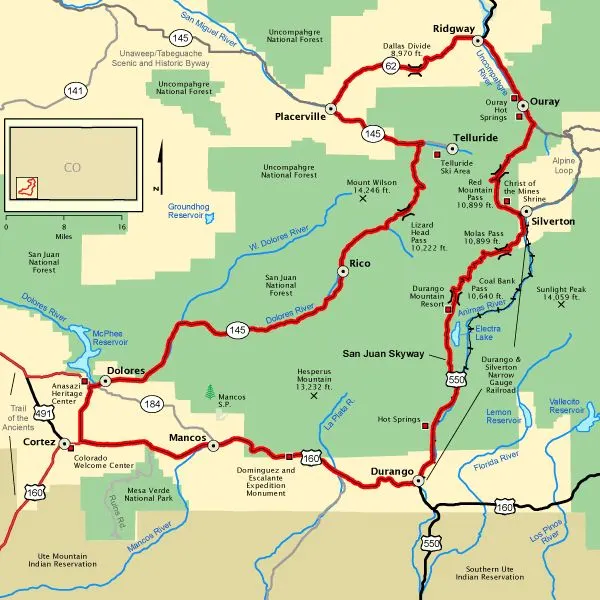
Nearest airport is DRO.
Frequently asked questions
When is the best time to visit Durango?
The best time to visit Durango is June–September, in Durango, Colorado, United States.
Where is Durango?
Durango is in Durango, Colorado, United States. The nearest major airport is DRO.
What is Durango known for?
Where a coal-fired narrow gauge railway still climbs to Silverton through the San Juans.